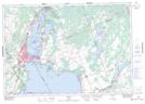
Maps showing McRae Point Provincial Park, Ontario, Ontario
McRae Point Provincial Park is a Conservation area located in Ontario, Ontario and has an elevation of 222 meters.
- Latitude: 44° 34' 17'' North (decimal: 44.5713888)
- Longitude: 79° 19' 41'' West (decimal: -79.3280555)
- Topography Feature Category: Conservation area
- Geographical Feature: Provincial Park
- Canadian Province/Territory: Ontario
- Elevation: 222 meters
- Location: Ontario
- Atlas of Canada Locator Map: McRae Point Provincial Park
- GPS Coordinate Locator Map: McRae Point Provincial Park Lat/Long
McRae Point Provincial Park NTS Map Sheets