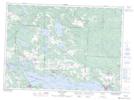
Maps showing St. Ange Island, Algoma, Ontario
St. Ange Island is a Island located in Algoma, Ontario and has an elevation of 179 meters.
- Latitude: 46° 16' 49'' North (decimal: 46.2802777)
- Longitude: 83° 36' 32'' West (decimal: -83.6088888)
- Topography Feature Category: Island
- Geographical Feature: Island
- Canadian Province/Territory: Ontario
- Elevation: 179 meters
- Location: Algoma
- Atlas of Canada Locator Map: St. Ange Island
- GPS Coordinate Locator Map: St. Ange Island Lat/Long
St. Ange Island NTS Map Sheets