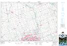
Maps showing St. Ives, Middlesex, Ontario
St. Ives is a Unincorporated area located in Middlesex, Ontario and has an elevation of 307 meters.
- Latitude: 43° 9' 26'' North (decimal: 43.1572222)
- Longitude: 81° 10' 00'' West (decimal: -81.1666666)
- Topography Feature Category: Unincorporated area
- Geographical Feature: Dispersed Rural Community
- Canadian Province/Territory: Ontario
- Elevation: 307 meters
- Location: Middlesex
- Atlas of Canada Locator Map: St. Ives
- GPS Coordinate Locator Map: St. Ives Lat/Long