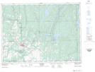
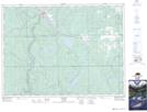
Maps showing St. Jean Baptiste Creek, Timiskaming, Ontario
St. Jean Baptiste Creek is a River located in Timiskaming, Ontario and has an elevation of 273 meters.
- Latitude: 47° 48' 16'' North (decimal: 47.8043999)
- Longitude: 79° 51' 44'' West (decimal: -79.8621999)
- Topography Feature Category: River
- Geographical Feature: Creek
- Canadian Province/Territory: Ontario
- Elevation: 273 meters
- Location: Timiskaming
- Atlas of Canada Locator Map: St. Jean Baptiste Creek
- GPS Coordinate Locator Map: St. Jean Baptiste Creek Lat/Long
St. Jean Baptiste Creek NTS Map Sheets