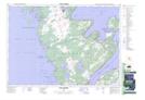
Maps showing St. Jean Point, Bruce, Ontario
St. Jean Point is a Cape located in Bruce, Ontario and has an elevation of 176 meters.
- Latitude: 44° 49' 24'' North (decimal: 44.8233333)
- Longitude: 81° 19' 4'' West (decimal: -81.3177777)
- Topography Feature Category: Cape
- Geographical Feature: Point
- Canadian Province/Territory: Ontario
- Elevation: 176 meters
- Location: Bruce
- Atlas of Canada Locator Map: St. Jean Point
- GPS Coordinate Locator Map: St. Jean Point Lat/Long
St. Jean Point NTS Map Sheets