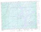
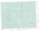
Maps showing St. Julien Lake, Algoma, Ontario
St. Julien Lake is a Lake located in Algoma, Ontario and has an elevation of 384 meters.
- Latitude: 48° 30' 3'' North (decimal: 48.5008333)
- Longitude: 84° 21' 22'' West (decimal: -84.3561111)
- Topography Feature Category: Lake
- Geographical Feature: Lake
- Canadian Province/Territory: Ontario
- Elevation: 384 meters
- Location: Algoma
- Atlas of Canada Locator Map: St. Julien Lake
- GPS Coordinate Locator Map: St. Julien Lake Lat/Long
St. Julien Lake NTS Map Sheets