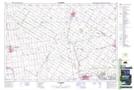
Maps showing St. Pauls Drain, Perth, Ontario
St. Pauls Drain is a Hydraulic construction located in Perth, Ontario and has an elevation of 340 meters.
- Latitude: 43° 18' 32'' North (decimal: 43.3088888)
- Longitude: 81° 3' 0'' West (decimal: -81.0500000)
- Topography Feature Category: Hydraulic construction
- Geographical Feature: Drain
- Canadian Province/Territory: Ontario
- Elevation: 340 meters
- Location: Perth
- Atlas of Canada Locator Map: St. Pauls Drain
- GPS Coordinate Locator Map: St. Pauls Drain Lat/Long