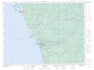
Maps showing Pitch Rock Harbour, Thunder Bay, Ontario
Pitch Rock Harbour is a Bay located in Thunder Bay, Ontario.
- Latitude: 48° 33' 42'' North (decimal: 48.5616999)
- Longitude: 86° 16' 12'' West (decimal: -86.2700000)
- Topography Feature Category: Bay
- Geographical Feature: Harbour
- Canadian Province/Territory: Ontario
- Location: Thunder Bay
- GPS Coordinate Locator Map: Pitch Rock Harbour Lat/Long