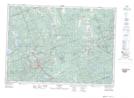
Maps showing Salmon Trout Creek, Hastings, Ontario
Salmon Trout Creek is a River located in Hastings, Ontario and has an elevation of 385 meters.
- Latitude: 45° 11' 12'' North (decimal: 45.1866666)
- Longitude: 77° 43' 16'' West (decimal: -77.7211111)
- Topography Feature Category: River
- Geographical Feature: Creek
- Canadian Province/Territory: Ontario
- Elevation: 385 meters
- Location: Hastings
- Atlas of Canada Locator Map: Salmon Trout Creek
- GPS Coordinate Locator Map: Salmon Trout Creek Lat/Long