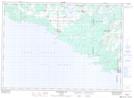
Maps showing The Sand Bluffs, Manitoulin, Ontario
The Sand Bluffs is a Mountain located in Manitoulin, Ontario and has an elevation of 178 meters.
- Latitude: 45° 36' 21'' North (decimal: 45.6058333)
- Longitude: 82° 8' 32'' West (decimal: -82.1422222)
- Topography Feature Category: Mountain
- Geographical Feature: Dunes
- Canadian Province/Territory: Ontario
- Elevation: 178 meters
- Location: Manitoulin
- Atlas of Canada Locator Map: The Sand Bluffs
- GPS Coordinate Locator Map: The Sand Bluffs Lat/Long
The Sand Bluffs NTS Map Sheets