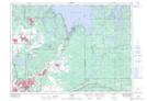
Maps showing Sand Pit, Sudbury, Ontario
Sand Pit is a Unincorporated area located in Sudbury, Ontario and has an elevation of 270 meters.
- Latitude: 46° 32' 7'' North (decimal: 46.5352777)
- Longitude: 80° 54' 43'' West (decimal: -80.9119444)
- Topography Feature Category: Unincorporated area
- Geographical Feature: Railway Point
- Canadian Province/Territory: Ontario
- Elevation: 270 meters
- Location: Sudbury
- Atlas of Canada Locator Map: Sand Pit
- GPS Coordinate Locator Map: Sand Pit Lat/Long