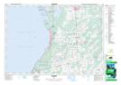
Maps showing Playford Flats, Bruce, Ontario
Playford Flats is a Low vegetation located in Bruce, Ontario and has an elevation of 227 meters.
- Latitude: 44° 39' 57'' North (decimal: 44.6658333)
- Longitude: 81° 8' 56'' West (decimal: -81.1488888)
- Topography Feature Category: Low vegetation
- Geographical Feature: Flats
- Canadian Province/Territory: Ontario
- Elevation: 227 meters
- Location: Bruce
- Atlas of Canada Locator Map: Playford Flats
- GPS Coordinate Locator Map: Playford Flats Lat/Long