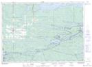
Maps showing Miller Island, Parry Sound, Ontario
Miller Island is a Island located in Parry Sound, Ontario and has an elevation of 184 meters.
- Latitude: 46° 0' 41'' North (decimal: 46.0113888)
- Longitude: 80° 29' 18'' West (decimal: -80.4883333)
- Topography Feature Category: Island
- Geographical Feature: Island
- Canadian Province/Territory: Ontario
- Elevation: 184 meters
- Location: Parry Sound
- Atlas of Canada Locator Map: Miller Island
- GPS Coordinate Locator Map: Miller Island Lat/Long