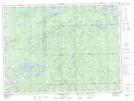
Maps showing Legarde Additional, Algoma, Ontario
Legarde Additional is a Geographical area located in Algoma, Ontario.
- Latitude: 48° 9' 0'' North (decimal: 48.1500000)
- Longitude: 85° 19' 40'' West (decimal: -85.3277777)
- Topography Feature Category: Geographical area
- Geographical Feature: Geographic Township
- Canadian Province/Territory: Ontario
- Location: Algoma
- Atlas of Canada Locator Map: Legarde Additional
- GPS Coordinate Locator Map: Legarde Additional Lat/Long
Legarde Additional NTS Map Sheets