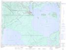
Maps showing Red Rock, Thunder Bay, Ontario
Red Rock is a Other municipal/district area - miscellaneous located in Thunder Bay, Ontario.
- Latitude: 48° 56' 25'' North (decimal: 48.9402777)
- Longitude: 88° 20' 28'' West (decimal: -88.3411111)
- Topography Feature Category: Other municipal/district area - miscellaneous
- Geographical Feature: Township Municipality
- Canadian Province/Territory: Ontario
- Location: Thunder Bay
- Atlas of Canada Locator Map: Red Rock
- GPS Coordinate Locator Map: Red Rock Lat/Long
Red Rock NTS Map Sheets