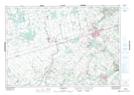
Maps showing Mill Creek, Dufferin, Ontario
Mill Creek is a River located in Dufferin, Ontario and has an elevation of 428 meters.
- Latitude: 43° 55' 15'' North (decimal: 43.9208333)
- Longitude: 80° 5' 00'' West (decimal: -80.0833333)
- Topography Feature Category: River
- Geographical Feature: Creek
- Canadian Province/Territory: Ontario
- Elevation: 428 meters
- Location: Dufferin
- Atlas of Canada Locator Map: Mill Creek
- GPS Coordinate Locator Map: Mill Creek Lat/Long
Mill Creek NTS Map Sheets