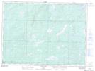
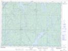
Maps showing Mills Lake, Sudbury, Ontario
Mills Lake is a Lake located in Sudbury, Ontario and has an elevation of 397 meters.
- Latitude: 47° 59' 29'' North (decimal: 47.9913888)
- Longitude: 82° 30' 27'' West (decimal: -82.5075000)
- Topography Feature Category: Lake
- Geographical Feature: Lake
- Canadian Province/Territory: Ontario
- Elevation: 397 meters
- Location: Sudbury
- Atlas of Canada Locator Map: Mills Lake
- GPS Coordinate Locator Map: Mills Lake Lat/Long
Mills Lake NTS Map Sheets