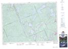
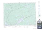
Maps showing Minden Bay, Haliburton, Ontario
Minden Bay is a Bay located in Haliburton, Ontario and has an elevation of 348 meters.
- Latitude: 45° 15' 19'' North (decimal: 45.2552777)
- Longitude: 78° 48' 1'' West (decimal: -78.8002777)
- Topography Feature Category: Bay
- Geographical Feature: Bay
- Canadian Province/Territory: Ontario
- Elevation: 348 meters
- Location: Haliburton
- Atlas of Canada Locator Map: Minden Bay
- GPS Coordinate Locator Map: Minden Bay Lat/Long
Minden Bay NTS Map Sheets