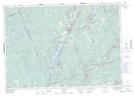
Maps showing Miners Creek, Haliburton, Ontario
Miners Creek is a River located in Haliburton, Ontario and has an elevation of 310 meters.
- Latitude: 44° 49' 13'' North (decimal: 44.8202777)
- Longitude: 78° 46' 35'' West (decimal: -78.7763888)
- Topography Feature Category: River
- Geographical Feature: Creek
- Canadian Province/Territory: Ontario
- Elevation: 310 meters
- Location: Haliburton
- Atlas of Canada Locator Map: Miners Creek
- GPS Coordinate Locator Map: Miners Creek Lat/Long
Miners Creek NTS Map Sheets