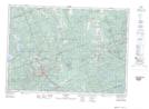
Maps showing Scotch Bush, Hastings, Ontario
Scotch Bush is a Unincorporated area located in Hastings, Ontario and has an elevation of 424 meters.
- Latitude: 45° 14' 23'' North (decimal: 45.2397222)
- Longitude: 77° 58' 42'' West (decimal: -77.9783333)
- Topography Feature Category: Unincorporated area
- Geographical Feature: Dispersed Rural Community
- Canadian Province/Territory: Ontario
- Elevation: 424 meters
- Location: Hastings
- Atlas of Canada Locator Map: Scotch Bush
- GPS Coordinate Locator Map: Scotch Bush Lat/Long