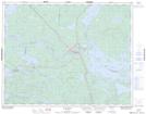
Maps showing Manitou Falls, Kenora, Ontario
Manitou Falls is a Falls located in Kenora, Ontario and has an elevation of 349 meters.
- Latitude: 50° 35' 00'' North (decimal: 50.5833333)
- Longitude: 93° 27' 19'' West (decimal: -93.4552777)
- Topography Feature Category: Falls
- Geographical Feature: Falls
- Canadian Province/Territory: Ontario
- Elevation: 349 meters
- Location: Kenora
- Atlas of Canada Locator Map: Manitou Falls
- GPS Coordinate Locator Map: Manitou Falls Lat/Long