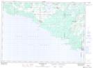
Maps showing Monument Corner, Manitoulin, Ontario
Monument Corner is a Unincorporated area located in Manitoulin, Ontario and has an elevation of 203 meters.
- Latitude: 45° 42' 47'' North (decimal: 45.7130555)
- Longitude: 82° 14' 42'' West (decimal: -82.2449999)
- Topography Feature Category: Unincorporated area
- Geographical Feature: Locality
- Canadian Province/Territory: Ontario
- Elevation: 203 meters
- Location: Manitoulin
- Atlas of Canada Locator Map: Monument Corner
- GPS Coordinate Locator Map: Monument Corner Lat/Long
Monument Corner NTS Map Sheets