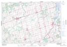
Maps showing Bond-Head, Ontario
Bond-Head is a Unincorporated area located in Ontario.
- Latitude: 44° 5' North (decimal: 44.0832999)
- Longitude: 79° 41' West (decimal: -79.6833000)
- Topography Feature Category: Unincorporated area
- Geographical Feature: Compact Rural Community
- Canadian Province/Territory: Ontario
- GPS Coordinate Locator Map: Bond-Head Lat/Long
Bond-Head NTS Map Sheets