Canada Topographic Maps

Seal River Topo Maps

Topography maps and Latitude/Longitude Location

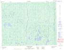
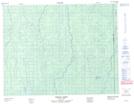
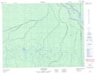
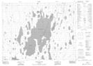
Maps showing Seal River, Cochrane, Ontario

Seal River is a River located in Cochrane, Ontario.

  • Latitude: 50° 59' 36'' North   (decimal: 50.9933333)
  • Longitude: 79° 42' 31'' West   (decimal: -79.7086111)
  • Topography Feature Category: River
  • Geographical Feature: River
  • Canadian Province/Territory: Ontario
  • Location: Cochrane
  • Atlas of Canada Locator Map: Seal River
  • GPS Coordinate Locator Map: Seal River Lat/Long

Seal River NTS Map Sheets

032L05 Corner Lakes Topographic Map at 1:50,000 scale

032L12 Hoelke Creek Topographic Map at 1:50,000 scale

032L13 Atik River Topographic Map at 1:50,000 scale

042I08 Kesagami Lake Topographic Map at 1:50,000 scale

032L Riviere Harricana Topographic Map at 1:250,000 scale

042I Moose River Topographic Map at 1:250,000 scale

 
Buy Topographic Maps DVD
Newsletter Sign-up

Yes, I want to receive map store discounts.


Bookmark and Share