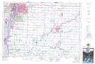
Maps showing Mooretown, Lambton, Ontario
Mooretown is a Unincorporated area located in Lambton, Ontario and has an elevation of 182 meters.
- Latitude: 42° 50' 21'' North (decimal: 42.8391666)
- Longitude: 82° 27' 52'' West (decimal: -82.4644444)
- Topography Feature Category: Unincorporated area
- Geographical Feature: Compact Rural Community
- Canadian Province/Territory: Ontario
- Elevation: 182 meters
- Location: Lambton
- Atlas of Canada Locator Map: Mooretown
- GPS Coordinate Locator Map: Mooretown Lat/Long