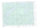
Maps showing Moose Island, Algoma, Ontario
Moose Island is a Island located in Algoma, Ontario.
- Latitude: 48° 13' 25'' North (decimal: 48.2236111)
- Longitude: 84° 9' 50'' West (decimal: -84.1638888)
- Topography Feature Category: Island
- Geographical Feature: Island
- Canadian Province/Territory: Ontario
- Location: Algoma
- Atlas of Canada Locator Map: Moose Island
- GPS Coordinate Locator Map: Moose Island Lat/Long
Moose Island NTS Map Sheets