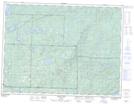
Maps showing Moose Point, Thunder Bay, Ontario
Moose Point is a Cape located in Thunder Bay, Ontario and has an elevation of 454 meters.
- Latitude: 48° 37' 26'' North (decimal: 48.6238888)
- Longitude: 89° 22' 52'' West (decimal: -89.3811111)
- Topography Feature Category: Cape
- Geographical Feature: Point
- Canadian Province/Territory: Ontario
- Elevation: 454 meters
- Location: Thunder Bay
- Atlas of Canada Locator Map: Moose Point
- GPS Coordinate Locator Map: Moose Point Lat/Long
Moose Point NTS Map Sheets