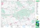
Maps showing St. Paschal Baylon, Ontario
St. Paschal Baylon is a Unincorporated area located in Ontario.
- Latitude: 45° 29' 41'' North (decimal: 45.4947000)
- Longitude: 75° 9' 22'' West (decimal: -75.1560999)
- Topography Feature Category: Unincorporated area
- Geographical Feature: Dispersed Rural Community
- Canadian Province/Territory: Ontario
- GPS Coordinate Locator Map: St. Paschal Baylon Lat/Long