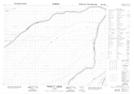
Maps showing Morrow Creek, Cochrane, Ontario
Morrow Creek is a River located in Cochrane, Ontario.
- Latitude: 50° 36' 27'' North (decimal: 50.6074999)
- Longitude: 81° 33' 27'' West (decimal: -81.5574999)
- Topography Feature Category: River
- Geographical Feature: Creek
- Canadian Province/Territory: Ontario
- Location: Cochrane
- Atlas of Canada Locator Map: Morrow Creek
- GPS Coordinate Locator Map: Morrow Creek Lat/Long
Morrow Creek NTS Map Sheets