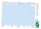
Maps showing Sebastopol Point, Northumberland, Ontario
Sebastopol Point is a Cape located in Northumberland, Ontario and has an elevation of 76 meters.
- Latitude: 43° 58' 59'' North (decimal: 43.9830555)
- Longitude: 77° 44' 37'' West (decimal: -77.743611)
- Topography Feature Category: Cape
- Geographical Feature: Point
- Canadian Province/Territory: Ontario
- Elevation: 76 meters
- Location: Northumberland
- Atlas of Canada Locator Map: Sebastopol Point
- GPS Coordinate Locator Map: Sebastopol Point Lat/Long