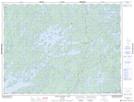
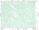
Maps showing Seggemak Lake, Kenora, Ontario
Seggemak Lake is a Lake located in Kenora, Ontario and has an elevation of 434 meters.
- Latitude: 49° 23' 9'' North (decimal: 49.3858333)
- Longitude: 92° 29' 26'' West (decimal: -92.4905555)
- Topography Feature Category: Lake
- Geographical Feature: Lake
- Canadian Province/Territory: Ontario
- Elevation: 434 meters
- Location: Kenora
- Atlas of Canada Locator Map: Seggemak Lake
- GPS Coordinate Locator Map: Seggemak Lake Lat/Long
Seggemak Lake NTS Map Sheets