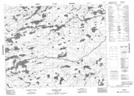
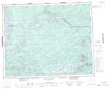
Maps showing Semia Creek, Kenora, Ontario
Semia Creek is a River located in Kenora, Ontario.
- Latitude: 51° 32' 32'' North (decimal: 51.5422222)
- Longitude: 91° 27' 24'' West (decimal: -91.4566666)
- Topography Feature Category: River
- Geographical Feature: Creek
- Canadian Province/Territory: Ontario
- Location: Kenora
- Atlas of Canada Locator Map: Semia Creek
- GPS Coordinate Locator Map: Semia Creek Lat/Long
Semia Creek NTS Map Sheets