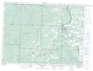
Maps showing Serpent Creek, Thunder Bay, Ontario
Serpent Creek is a River located in Thunder Bay, Ontario.
- Latitude: 48° 29' 28'' North (decimal: 48.4911111)
- Longitude: 89° 58' 32'' West (decimal: -89.9755555)
- Topography Feature Category: River
- Geographical Feature: Creek
- Canadian Province/Territory: Ontario
- Location: Thunder Bay
- Atlas of Canada Locator Map: Serpent Creek
- GPS Coordinate Locator Map: Serpent Creek Lat/Long
Serpent Creek NTS Map Sheets