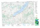
Maps showing Serpent Mounds Provincial Park, Peterborough, Ontario
Serpent Mounds Provincial Park is a Conservation area located in Peterborough, Ontario and has an elevation of 208 meters.
- Latitude: 44° 12' 33'' North (decimal: 44.2091666)
- Longitude: 78° 9' 17'' West (decimal: -78.1547222)
- Topography Feature Category: Conservation area
- Geographical Feature: Provincial Park
- Canadian Province/Territory: Ontario
- Elevation: 208 meters
- Location: Peterborough
- Atlas of Canada Locator Map: Serpent Mounds Provincial Park
- GPS Coordinate Locator Map: Serpent Mounds Provincial Park Lat/Long
Serpent Mounds Provincial Park NTS Map Sheets