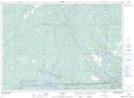
Maps showing Servos, Sudbury, Ontario
Servos is a Unincorporated area located in Sudbury, Ontario and has an elevation of 211 meters.
- Latitude: 46° 12' 20'' North (decimal: 46.2055555)
- Longitude: 80° 43' 36'' West (decimal: -80.7266666)
- Topography Feature Category: Unincorporated area
- Geographical Feature: Railway Point
- Canadian Province/Territory: Ontario
- Elevation: 211 meters
- Location: Sudbury
- Atlas of Canada Locator Map: Servos
- GPS Coordinate Locator Map: Servos Lat/Long