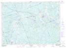
Maps showing Sardine Can Run, Parry Sound, Ontario
Sardine Can Run is a Rapids located in Parry Sound, Ontario.
- Latitude: 45° 43' North (decimal: 45.7166999)
- Longitude: 79° 59' West (decimal: -79.9833000)
- Topography Feature Category: Rapids
- Geographical Feature: Run
- Canadian Province/Territory: Ontario
- Location: Parry Sound
- GPS Coordinate Locator Map: Sardine Can Run Lat/Long
Sardine Can Run NTS Map Sheets