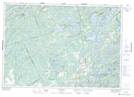
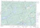
Maps showing Sharbot Lake, Frontenac, Ontario
Sharbot Lake is a Lake located in Frontenac, Ontario and has an elevation of 201 meters.
- Latitude: 44° 46' 6'' North (decimal: 44.7683333)
- Longitude: 76° 41' 14'' West (decimal: -76.6872222)
- Topography Feature Category: Lake
- Geographical Feature: Lake
- Canadian Province/Territory: Ontario
- Elevation: 201 meters
- Location: Frontenac
- Atlas of Canada Locator Map: Sharbot Lake
- GPS Coordinate Locator Map: Sharbot Lake Lat/Long
Sharbot Lake NTS Map Sheets