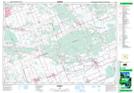
Maps showing Shaws Creek, Russell, Ontario
Shaws Creek is a River located in Russell, Ontario and has an elevation of 67 meters.
- Latitude: 45° 23' 17'' North (decimal: 45.3880555)
- Longitude: 75° 24' 15'' West (decimal: -75.4041666)
- Topography Feature Category: River
- Geographical Feature: Creek
- Canadian Province/Territory: Ontario
- Elevation: 67 meters
- Location: Russell
- Atlas of Canada Locator Map: Shaws Creek
- GPS Coordinate Locator Map: Shaws Creek Lat/Long