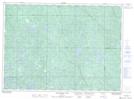
Maps showing 139, Ontario
139 is a Geographical area located in Ontario.
- Latitude: 46° 35' North (decimal: 46.5833000)
- Longitude: 82° 23' West (decimal: -82.3832999)
- Topography Feature Category: Geographical area
- Geographical Feature: Geographic Township
- Canadian Province/Territory: Ontario
- GPS Coordinate Locator Map: 139 Lat/Long
139 NTS Map Sheets