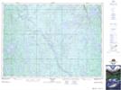
Maps showing Marshay, Sudbury, Ontario
Marshay is a Geographical area located in Sudbury, Ontario.
- Latitude: 47° 11' 32'' North (decimal: 47.1922222)
- Longitude: 81° 23' 34'' West (decimal: -81.3927777)
- Topography Feature Category: Geographical area
- Geographical Feature: Geographic Township
- Canadian Province/Territory: Ontario
- Location: Sudbury
- Atlas of Canada Locator Map: Marshay
- GPS Coordinate Locator Map: Marshay Lat/Long