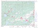
Maps showing Old Sawmill Lake, Sudbury, Ontario
Old Sawmill Lake is a Lake located in Sudbury, Ontario and has an elevation of 417 meters.
- Latitude: 46° 37' 00'' North (decimal: 46.6166666)
- Longitude: 81° 29' 49'' West (decimal: -81.4969444)
- Topography Feature Category: Lake
- Geographical Feature: Lake
- Canadian Province/Territory: Ontario
- Elevation: 417 meters
- Location: Sudbury
- Atlas of Canada Locator Map: Old Sawmill Lake
- GPS Coordinate Locator Map: Old Sawmill Lake Lat/Long