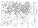
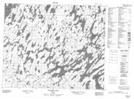
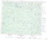
Maps showing Wunnumin Lake Indian Reserve 86, Kenora, Ontario
Wunnumin Lake Indian Reserve 86 is a Indian Reserve located in Kenora, Ontario.
- Latitude: 52° 54' North (decimal: 52.9000000)
- Longitude: 89° 00' West (decimal: -88.9999999)
- Topography Feature Category: Indian Reserve
- Geographical Feature: Indian Reserve
- Canadian Province/Territory: Ontario
- Location: Kenora
- GPS Coordinate Locator Map: Wunnumin Lake Indian Reserve 86 Lat/Long
Wunnumin Lake Indian Reserve 86 NTS Map Sheets