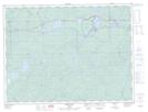
Maps showing Philip Creek, Ontario
Philip Creek is a River located in Ontario.
- Latitude: 48° 43' 57'' North (decimal: 48.7324999)
- Longitude: 85° 54' 7'' West (decimal: -85.9019000)
- Topography Feature Category: River
- Geographical Feature: Creek
- Canadian Province/Territory: Ontario
- GPS Coordinate Locator Map: Philip Creek Lat/Long
Philip Creek NTS Map Sheets