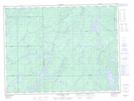
Maps showing Sheila Creek, Algoma, Ontario
Sheila Creek is a River located in Algoma, Ontario.
- Latitude: 48° 59' 55'' North (decimal: 48.9986111)
- Longitude: 85° 9' 15'' West (decimal: -85.1541666)
- Topography Feature Category: River
- Geographical Feature: Creek
- Canadian Province/Territory: Ontario
- Location: Algoma
- Atlas of Canada Locator Map: Sheila Creek
- GPS Coordinate Locator Map: Sheila Creek Lat/Long
Sheila Creek NTS Map Sheets