Canada Topographic Maps

Sandfield Topo Maps

Topography maps and Latitude/Longitude Location

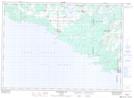
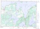
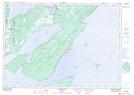
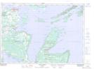
Maps showing Sandfield, Manitoulin, Ontario

Sandfield is a Geographical area located in Manitoulin, Ontario.

  • Latitude: 45° 44' 2'' North   (decimal: 45.7338888)
  • Longitude: 82° 3' 00'' West   (decimal: -82.0499999)
  • Topography Feature Category: Geographical area
  • Geographical Feature: Geographic Township
  • Canadian Province/Territory: Ontario
  • Location: Manitoulin
  • Atlas of Canada Locator Map: Sandfield
  • GPS Coordinate Locator Map: Sandfield Lat/Long

Sandfield NTS Map Sheets

041G09 Providence Bay Topographic Map at 1:50,000 scale

041G16 Kagawong Topographic Map at 1:50,000 scale

041H12 Manitowaning Topographic Map at 1:50,000 scale

041H13 Little Current Topographic Map at 1:50,000 scale

041G Alpena Topographic Map at 1:250,000 scale

041H Tobermory Topographic Map at 1:250,000 scale

 
Buy Topographic Maps DVD
Newsletter Sign-up

Yes, I want to receive map store discounts.


Bookmark and Share