Canada Topographic Maps

Byers Creek Topo Maps

Topography maps and Latitude/Longitude Location

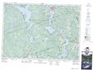
Maps showing Byers Creek, Ontario

Byers Creek is a River located in Ontario.

  • Latitude: 45° 22' North   (decimal: 45.3666999)
  • Longitude: 77° 37' West   (decimal: -77.6167000)
  • Topography Feature Category: River
  • Geographical Feature: Creek
  • Canadian Province/Territory: Ontario
  • GPS Coordinate Locator Map: Byers Creek Lat/Long

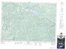
Byers Creek NTS Map Sheets

031F05 Barry's Bay Topographic Map at 1:50,000 scale

031F06 Brudenell Topographic Map at 1:50,000 scale

031F Pembroke Topographic Map at 1:250,000 scale

 
Buy Topographic Maps DVD
Newsletter Sign-up

Yes, I want to receive map store discounts.


Bookmark and Share