Canada Topographic Maps

Channel Point Topo Maps

Topography maps and Latitude/Longitude Location

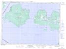
Maps showing Channel Point, Ontario

Channel Point is a Cape located in Ontario.

  • Latitude: 45° 58' North   (decimal: 45.9666999)
  • Longitude: 83° 16' West   (decimal: -83.2667000)
  • Topography Feature Category: Cape
  • Geographical Feature: Point
  • Canadian Province/Territory: Ontario
  • GPS Coordinate Locator Map: Channel Point Lat/Long

Channel Point NTS Map Sheets

041G14 Meldrum Bay Topographic Map at 1:50,000 scale

041G Alpena Topographic Map at 1:250,000 scale

 
Buy Topographic Maps DVD
Newsletter Sign-up

Yes, I want to receive map store discounts.


Bookmark and Share