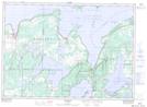
Maps showing Sandy Cove, Manitoulin, Ontario
Sandy Cove is a Bay located in Manitoulin, Ontario and has an elevation of 184 meters.
- Latitude: 45° 58' 31'' North (decimal: 45.9752777)
- Longitude: 82° 17' 12'' West (decimal: -82.2866666)
- Topography Feature Category: Bay
- Geographical Feature: Cove
- Canadian Province/Territory: Ontario
- Elevation: 184 meters
- Location: Manitoulin
- Atlas of Canada Locator Map: Sandy Cove
- GPS Coordinate Locator Map: Sandy Cove Lat/Long