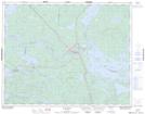
Maps showing Sandy Creek, Kenora, Ontario
Sandy Creek is a River located in Kenora, Ontario and has an elevation of 350 meters.
- Latitude: 50° 38' 55'' North (decimal: 50.6486111)
- Longitude: 93° 19' 26'' West (decimal: -93.3238888)
- Topography Feature Category: River
- Geographical Feature: Creek
- Canadian Province/Territory: Ontario
- Elevation: 350 meters
- Location: Kenora
- Atlas of Canada Locator Map: Sandy Creek
- GPS Coordinate Locator Map: Sandy Creek Lat/Long