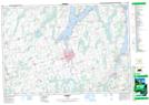
Maps showing Sandy Point, Victoria, Ontario
Sandy Point is a Unincorporated area located in Victoria, Ontario and has an elevation of 264 meters.
- Latitude: 44° 29' 15'' North (decimal: 44.4875000)
- Longitude: 78° 40' 14'' West (decimal: -78.6705555)
- Topography Feature Category: Unincorporated area
- Geographical Feature: Compact Rural Community
- Canadian Province/Territory: Ontario
- Elevation: 264 meters
- Location: Victoria
- Atlas of Canada Locator Map: Sandy Point
- GPS Coordinate Locator Map: Sandy Point Lat/Long
Sandy Point NTS Map Sheets